Exploring wildlife through maps.
I recently completed an online course from the University of Oxford's Continuing Education Department, introducing me to the joys of GIS (Geographic Information Science/Systems) - I've always liked browsing maps, so to be able to create my own is just brilliant!

I thought I'd share my first map(s) - all about Curlew (CU), Lapwing (L) and Snipe (SN) in East Norfolk, which happens to be where I have been surveying farmland for evidence of breeding of these declining waders for the RSPB.
I gathered species presence data from BTO's BirdTrack records. BirdTrack is a citizen science project in which birders record lists of their sightings in 1km tetrads (fancy word for square) and upload them to the BirdTrack site, usually via the app, so that the clever bods at BTO can gain an insight into population trends and other details, such as the effect of climate change, important for their conservation. It's great at any time of the year to see what is going on in almost real time, but it is especially exciting during the migration seasons when you can see which species are arriving and which are leaving, and can compare it to historical data.
So take a good look at my course assignment map below, see if you can spot areas where all three species like to hang out, and some areas where they don't (middle section of the area I looked at)!

This map shows number of species recorded in the tetrads in association with land that has a conservation designation (County Wildlife Sites, SSSI's, National Park, AONB). I used several different mapping techniques (combinations of vector and raster layers) to create this map using QGIS open source software. However, I really wanted to see if there was any relationship with farmland and to add that layer in too made it look rather too messy for my assignment map!
Since finishing the course, I've knocked out a few more maps showing the same BirdTrack data but in different ways and with the Agricultural Farmland Classification.


Most of these maps require careful study to fully interpret the colour symbology (working on how to improve that when "publishing"), but there are several things that can be learned:
- CU and SN together was not recorded in any square
- The middle third of the area has less density of CU, L and SN
- The middle third of the area has the most Grade 1 Agricultural Land Classification
- BirdTrack data for the southern third (Breydon Water & associated marshes) suggests all squares have all three species recorded, but when this data is explored further much of this area is inaccessible and appears to be extrapolated from adjacent or nearby squares
- Records, particularly of more than one species, seem to be associated with CWS and SSSIs
I am still learning GIS techniques and there are tools to test some of these observations statistically, so beware, this blog may yet see more maps! I hope you like them as much as I do?
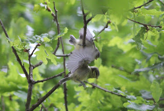
If you don't (??) then here are some birdy pictures:
Curlew - not in East Norfolk this one, but up North at RSPB Titchwell Marsh (1km tetrad TF7544).

A lot of Lapwing at Breydon Water (TG5108) - and if you want to see more about Lapwing go to my previous post.

And a Snipe also up North at NWT Cley Marshes (TG0544)

But to prove they can be found on farmland in the East here are eight (of thirteen) in a harvested sugar beet field near Clippesby (TG4215)


Comments
Post a Comment